
Optimizing UAV Teams For Efficient Missions

The method enhances planning for missions by multiple UAVs, improving efficiency and enabling applications like infrastructure inspection and environmental monitoring.

Unmanned aerial vehicles (UAVs), or drones, have demonstrated their utility in various applications, including environmental monitoring, agriculture, search and rescue, and aerial filming. Currently, these tasks are mostly performed by individual drones, but there is a growing interest in using teams of autonomous or semi-autonomous UAVs to cover larger areas more efficiently. Researchers are developing technologies to enable the simultaneous deployment and coordination of multiple UAVs for enhanced mission capabilities.
Czech Technical University researchers have introduced a new method for planning minimum-energy paths for UAV teams. This approach considers drones’ battery capacities to minimize energy consumption and optimize flight speed, enabling efficient teamwork in mission environments.

The team aimed to create a computational model that coordinates multiple UAVs to achieve energy-efficient coverage during missions. Unlike previous frameworks, their approach considers optimal flight speeds and individual battery constraints of the UAV team.
The researchers approached the allocation of cells to UAVs and their mission planning by formulating the problem as a multiple set traveling salesman problem (MS-TSP). This mathematical problem parallels a scenario where multiple salesmen must visit cities grouped in sets, visiting each set once before returning to their starting point, all at minimal travel cost.
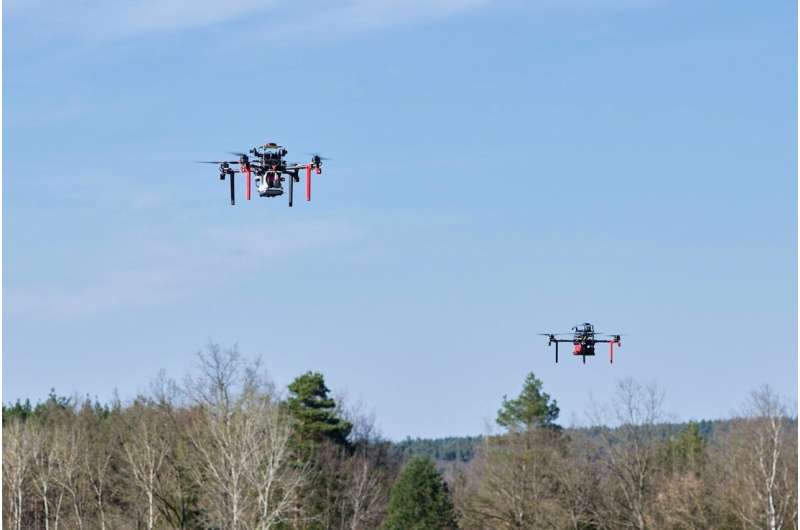
The researchers tested their approach in simulations and a real-world experiment, deploying it on a drone team to monitor a specified area. Their method surpassed previous approaches, enhancing coverage speed and reducing energy consumption by up to 40.4%.
The new approach from this study could enable the use of UAV teams in real-world scenarios, especially for tasks requiring extended flight times like infrastructure inspection, precision agriculture, and environmental monitoring. Nekovář and colleagues have made the underlying code available on GitHub for other researchers to implement and test.
In future studies, they aim to enhance their approach to plan UAV coverage in three dimensions and incorporate localization uncertainty. They also intend to enable recharging and swapping of UAVs during missions, extending the team’s battery lifespan and enabling longer missions.