
PIX4Dcatch augmented reality update – DRONELIFE
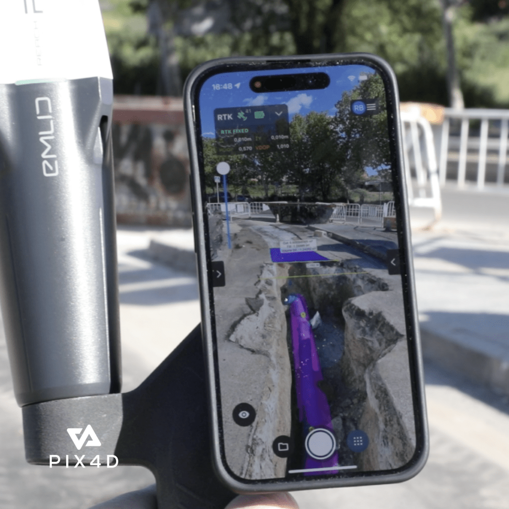
PIX4Dcatch, known for its user-friendly interface, combines photogrammetry and LiDAR technologies with RTK positioning to produce highly accurate 3D models. These models achieve precision levels up to 1 cm under optimal conditions, with typical accuracies ranging from less than 5 cm to 10 cm. The application is crucial for documenting, visualizing, and analyzing real-world site conditions and measurements, which are readily exportable to CAD/GIS platforms for further use in project planning and collaboration.
Pix4Dcatch with Augmented Reality Features
The 2.0 version enriches the user experience with new AR features, allowing for real-time interactions with project sites. “Using AR, plans can be overlaid on-site and visualized for rapid approval during project design, construction, and post-construction inspections,” the company stated. This functionality is particularly useful for instant communication of annotations and field notes from office to site, enhancing the efficiency of project workflows.
Further enhancements include integration with three additional RTK devices: the Emlid Reach RX, the Trimble DA2, and the Bad Elf Flex. This broadens the scope of device compatibility, providing more options for users in various operational environments. PIX4Dcatch 2.0 also introduces automatic Tag Detection for Ground Control Points (GCPs) and Measured Target Points (MTPs), as well as compatibility with selected base stations.
Available for purchase through the Pix4D website, selected resellers, or as an in-app option in the App Store, PIX4Dcatch 2.0 represents a significant step forward in mobile 3D scanning technology. It seamlessly integrates with Pix4D’s comprehensive suite of cloud and desktop-based photogrammetry processing tools.
Pix4D has established itself with offices across the globe, including the USA, Germany, Spain, Romania, and Japan, and continues to innovate in the field of geospatial data processing, delivering solutions that transform images into detailed georeferenced maps and models.
Read more: